Trail Walking La Canourgue - 48_la-canourgue_champerboux - Photo

48_la-canourgue_champerboux

 jab31
jab31

User

© OpenStreetMap contributors
Length
Length
20 km
Max alt
Max alt
951 m
Uphill gradient
Uphill gradient
642 m
Km-Effort
Km-Effort  
28 km
Min alt
Min alt
560 m
Downhill gradient
Downhill gradient
267 m
Boucle
Boucle
No
Creation date :
2019-12-21 17:17:04.415
Updated on :
2019-12-23 08:33:15.582

(0 Reviews)

Walking
Walking
--
Difficulty : Unknown

Scan this QR Code to open this trail in the SityTrail application

FREE GPS app for hiking

Logo SityTrail SityTrail

IGN / Geographical institutes

Download SityTrail from the App Store Download SityTrail from Google Play

Logo SityTrail SityTrail World

The world is yours!

Download SityTrail from the App Store Download SityTrail from Google Play Download SityTrail on Huawei AppGallery

About

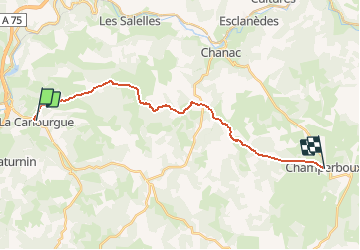
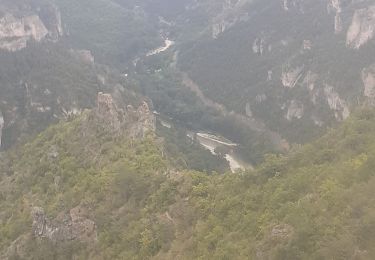
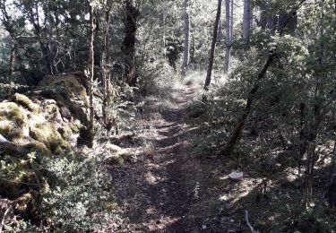
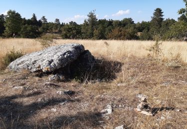
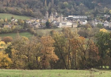
Trail Walking of 20 km to be discovered at Occitania, Lozère, La Canourgue. This trail is proposed by jab31.

Description

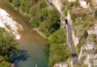
Etape 3 du Chemin de Saint Guilhem

Elevation profile

Positioning

Country:
France
Region :
Occitania
Department/Province :
Lozère
Municipality :
La Canourgue
Location:
La Canourgue
Start:(UTM)
517158 ; 4919937 (31T) N.

Trails nearby

Trail Walking La Canourgue - la canourgue les vignes - Photo
Walking
RoMo

Walking

Difficult
La Canourgue, Occitania, Lozère, France
25 km | 37 km-effort
7h 37min
No
Trail Walking La Canourgue - Dessus la canourgue - Photo
Walking
peillo

Walking

Difficult
La Canourgue, Occitania, Lozère, France
9.1 km | 14.4 km-effort
3h 48min
No
Trail Walking La Canourgue - Au-dessus de La Canourgue - Photo
Walking
vertygo

Walking

Medium
La Canourgue, Occitania, Lozère, France
12.7 km | 18.5 km-effort
3h 9min
Yes
Trail Walking Saint-Saturnin - Vers l'antenne de La Canourgue - Photo
Walking
Alain-49

Walking

Easy
Saint-Saturnin, Occitania, Lozère, France
6.9 km | 8.8 km-effort
1h 42min
Yes
Trail Walking Banassac-Canilhac - GR60 jour 7 - Photo
Walking
werth

Walking

Difficult
Banassac-Canilhac, Occitania, Lozère, France
22 km | 29 km-effort
9h 43min
No
Trail Other activity La Canourgue - Atlamed - La Canourgue - Les Vignes - Photo
Other activity
jbtregouet

Other activity

Very easy
La Canourgue, Occitania, Lozère, France
27 km | 38 km-effort
6h 30min
No
Trail Other activity La Canourgue - le chemin des falaises  - Photo
Other activity
Lecoester

Other activity

Easy
La Canourgue, Occitania, Lozère, France
12.1 km | 16.4 km-effort
2h 55min
Yes
Trail Cycle La Canourgue - La Lozérienne édition 2009 - 47 km - Photo
Cycle
tracegps

Cycle

Difficult
La Canourgue, Occitania, Lozère, France
47 km | 59 km-effort
2h 30min
Yes
Trail Cycle La Canourgue - La Lozérienne édition 2009 - 84 km - Photo
Cycle
tracegps

Cycle

Difficult
La Canourgue, Occitania, Lozère, France
86 km | 113 km-effort
3h 30min
Yes


Close
My subscriptions